Connect Staveley (Derbyshire) with Slow Ways
We’re creating a network of walking routes that connect all of Britain’s towns, cities and national parks
more walks and reviews are needed to fully connect Staveley (Derbyshire) to the verified network. Can you give a hike and help?
Give a hike!Staveley (Derbyshire)
Derbyshire
Slow Ways linking Staveley (Derbyshire) and Bolsover, Chesterfield, Clowne, Dronfield, Eckington (Sheffield)
England / Derbyshire / Staveley (Derbyshire)
Staveley (Derbyshire)’s five Slow Ways are 55% checked
Help connect Staveley (Derbyshire)
Many Slow Ways have several route options. Some will be better than others, or good for different reasons.
Our goal is for each Slow Way to have at least one route that is verified and surveyed. To be verified – and get its snail badge – a route needs at least three positive reviews.
Give a hike and help get a for every one of Staveley (Derbyshire)’s Slow Ways.
Walk to Staveley (Derbyshire) from further afield
| Slow Way | Route | To do | ||||||||
|---|---|---|---|---|---|---|---|---|---|---|

Chesterfield—Staveley (Derbyshire)
|
Chesta one |
|
U U |
|
Pioneer me | Distance 8km/5mi | Ascent 126m | Descent 152m | ||
Chesterfield—Staveley (Derbyshire)
|
Chesta two |
|
U U |
|
Survey me | Distance 8km/5mi | Ascent 84m | Descent 110m | ||
|
Dronfield—Staveley (Derbyshire)
|
Drosta one |
|
U U |
|
Pioneer me | Distance 11km/7mi | Ascent 182m | Descent 252m | ||

Dronfield—Staveley (Derbyshire)
|
Drosta two |
|
2 X |
|
Review me | Distance 10km/6mi | Ascent - | Descent - | ||

Eckington (Sheffield)—Staveley (Derbyshire)
|
Ecksta one |
|
|
U U |
|
Double check | Distance 6km/4mi | Ascent 82m | Descent 112m | |
|
Eckington (Sheffield)—Staveley (Derbyshire)
|
Ecksta two |
|
U U |
|
Verify me | Distance 8km/5mi | Ascent - | Descent - | ||

Staveley (Derbyshire)—Bolsover
|
Stabol one |
|
|
U U |
|
Double check | Distance 9km/5mi | Ascent 236m | Descent 140m | |

Staveley (Derbyshire)—Bolsover
|
Stabol two |
|
U U |
|
Verify me | Distance 8km/5mi | Ascent - | Descent - | ||

Staveley (Derbyshire)—Clowne
|
Staclo one |
|
|
U U |
|
Double check | Distance 7km/4mi | Ascent 129m | Descent 67m | |

Staveley (Derbyshire)—Clowne
|
Staclo two |
|
U U |
|
Verify me | Distance 7km/5mi | Ascent - | Descent - |
Fancy stretching your legs a bit more?
If you’ve polished off all of the routes between Staveley (Derbyshire) and its neighbours, how about walking its whole web?
This includes the great ring of routes that join its neighbours to each other!
Collective progress
50% of Staveley (Derbyshire)’s five route options are drawn, reviewed, surveyed and/or verified
10/10
8/10
1/10
1/10
5 people have contributed to Staveley (Derbyshire)’s Slow Ways
1 people have pledged to walk and review a route
2 people have surveyed a route in Staveley (Derbyshire)
64km out of 82km have been walked and reviewed
117km of reviews have been shared in Staveley (Derbyshire)
Latest Updates
The plotting is ab it approximate ion this first section, but with the aid of the OS map the intention is obvious and quiet roads lead from the town centre across the inner bypass and through an industrial estate....
StephenWalker
I used the direct path from the canal, which climbs eastwards towards the church to join Church Street into the town centre....
StephenWalker
I followed this route from Staveley, the last leg of a Chesterfield - Bolsover- Staveley - Chesterfield circular walk. I enjoyed the route throughout, despite the unattractive entry to Chesterfield itself. There were refreshments and canal-related information available at Hollingwood Lock....
StephenWalker
After a short stretch along the pavement, past the former colliery, a cycle way takes us off the roadside across the River Doe Lee and provides a pleasant surfaced trail to Long Duckmanton. Just follow the cycle path towards Staveley and after crossing the Pennine Bridleway trail, joins Inkersall Road for a short walk to the hub....
StephenWalker
A short section of pavement crosses an old rail route which may eventually offer a more direct route to Staveley. The Methodist Chapel is an interesting and well maintained building opposite where our faded signed route takes a track. Again this path doesn't follow the definitive path but stick with the walked and plotted route and all will be fine....
Ken
Ken added Stabol two, a new walk from Staveley (Derbyshire) to Bolsover
Walk this routeFrom Staveley Market Place the route passes close by a large supermarket so top up because there's not much on this Slow Way. The route passes a sports field and becomes a little overgrown before arriving at a small industrial estate which houses Drone Valley Brewery....
Ken
Ken added Drosta two, a new walk from Dronfield to Staveley (Derbyshire)
Walk this routeJust beyond Renishaw the route diverts away from the Trans Pennine Trail (it is worth carrying on 100 yards past the turning point to see the abandoned Renishaw station platform which make a good resting point) and crosses fields, the current train line via a bridge and then across the River Rother before an indistinct and poorly marked path crosses Eckington golf course before you follow roads to the meeting point in Eckington....
paul.scholey
There are a couple of awkward navigation moments as you follow the back streets through Chesterfield, crossing above the busy A61 and then crossing a number of smaller, but busy roads near Chesterfield train station but after that the navigation is easy. The only negative is the first, short stretch along the canal until you reach Tapton Lock is blighted by rubbish and hemmed in between housing developments - but it improves substantially after Tapton Lock....
paul.scholey
Andrew Sheldon took this photo on Ecksta one
Walk this routeThe Slow Ways route from Staveley to Eckington was one of the more interesting I've walked. As with many Slow Ways walks, the start and end feel slightly artificial, although that is not really a criticism as a route needs to start and finish somewhere. However, this, in turn led the route to the most difficult aspects of the route. As a final point, this route was less accurately plotted than most Slow Ways I've walked and while this did not result in me ever getting lost, was frustrating at times....
Andrew Sheldon
A near-perfect Slow Way joining Chesterfield and Staveley, almost entirely along the Chesterfield Canal....
Andrew Sheldon
paul.scholey added Ecksta two, a new walk from Eckington (Sheffield) to Staveley (Derbyshire)
Walk this routeAt the end of Breck Lane the route meets a busy road with little or no verge especially as it approaches the narrow bridge controlled by lights for single way traffic....
Ken
This was the last walk of three, Staveley, Clowne, Bolsover, Staveley and turned out to be the major challenge. Beyond the farm it was a track but the path east across the field was not apparent so I stayed on the track to discover a walked path leading to the motorway crossing. Hitting the cycle track I was back on my outward Staveley Clowne route and ignored the loop to the church....
Ken
Ken added Staclo two, a new walk from Staveley (Derbyshire) to Clowne
Walk this routeNetherthorpe Grammar School can trace its origins back to 1572 when four local families, the Sitwell, De Rodes, Cavendish and Frechevilles decided to establish a school to serve the local people of Staveley. Another section of field edge path leads to the cycle track then it's plain sailing....
Ken
From Staveley Market Place with it's statue / sculpture marking the history of the town it's a short walk to join the Chesterfield canal which is followed all the way....
Ken
It's hard to follow the marked route into the centre of Staveley but there are a variety of paths/back streets which go in the right direction and with a map it's not hard to find a way to get there....
James & Jill
Cambo added Chesta two, a new walk from Chesterfield to Staveley (Derbyshire)
Walk this routeMartin Hibbert added Stabol one, a new walk from Staveley (Derbyshire) to Bolsover
Walk this routeSlow Ways added Chesta one, a new walk from Chesterfield to Staveley (Derbyshire)
Walk this routeSlow Ways added Drosta one, a new walk from Dronfield to Staveley (Derbyshire)
Walk this routeSlow Ways added Ecksta one, a new walk from Eckington (Sheffield) to Staveley (Derbyshire)
Walk this routeSlow Ways added Staclo one, a new walk from Staveley (Derbyshire) to Clowne
Walk this route
Staveley (Derbyshire), Sun 28 April
11°
Light rain
Don’t forget your raincoat!
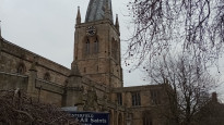
Staveley (Derbyshire)’s Slow Ways starting point
Grid ref
SK4324874600
Lat / Lon
53.26667° / -1.35304°
Easting / Northing
443,248E / 374,601N
what3words
Fancy stretching your legs a bit more?
If you’ve polished off all of the routes between Staveley (Derbyshire) and its neighbours, how about walking its whole web?
This includes the great ring of routes that join its neighbours to each other!
Facilities
Users have reported that the following facilities can be found within 1km of Staveley (Derbyshire)'s meeting point
Public toilet
Wheelchair accessible toilet
Supermarket or convenience shop
Restaurant, cafe or pub
Accommodation
Accommodation for under £50 a night
Campsite
Bothy
Free wifi
Mobility scooter hire
Off-road wheelchair hire
Disabled Parking
Train station
Bus stop
Ferry
Official ‘Walkers are Welcome’ town
Help us improve this information by signing up or logging in and carrying out a quick survey of Staveley (Derbyshire)